Carnegie Mellon University · Kantor Lab

Geospatially Grounded SLAM for Invasive Species Localization

3D SLAM + semantic labeling for fast Tree-of-Heaven monitoring at forest scale.

Geospatial Robotics Semantic Mapping Invasive Species Response
Kantor Lab • Robotics Institute • Carnegie Mellon University

Overview

Why invasive species mapping matters, what makes it hard, and what this project delivers.

Problem

Invasive tree species such as Tree-of-Heaven (Ailanthus altissima) can outcompete native vegetation, disrupt ecosystems, and increase long-term management costs. Effective control depends on knowing where infestations are and how they spread across large forested areas.

Challenge

Manual surveys and hand-labeling are labor-intensive and don't scale. Forest conditions also introduce hard robotics issues like under-canopy localization uncertainty and seasonal appearance variation.

Our Solution

A scalable pipeline that builds high-fidelity 3D maps and semantically labels Tree-of-Heaven within them, producing geolocalized outputs as heatmaps and GeoTIFF layers for field action.

Methodology Overview

The methodology pairs geometry, semantics, and geospatial alignment into a single end-to-end workflow for actionable Tree-of-Heaven localization.
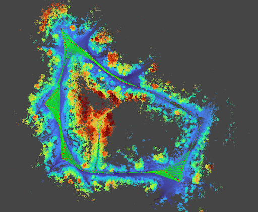
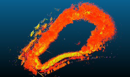
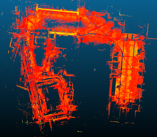
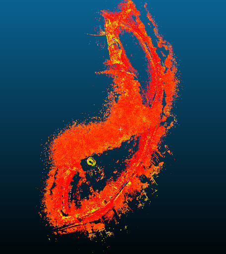
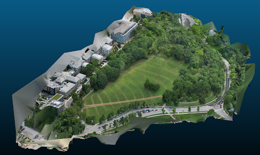
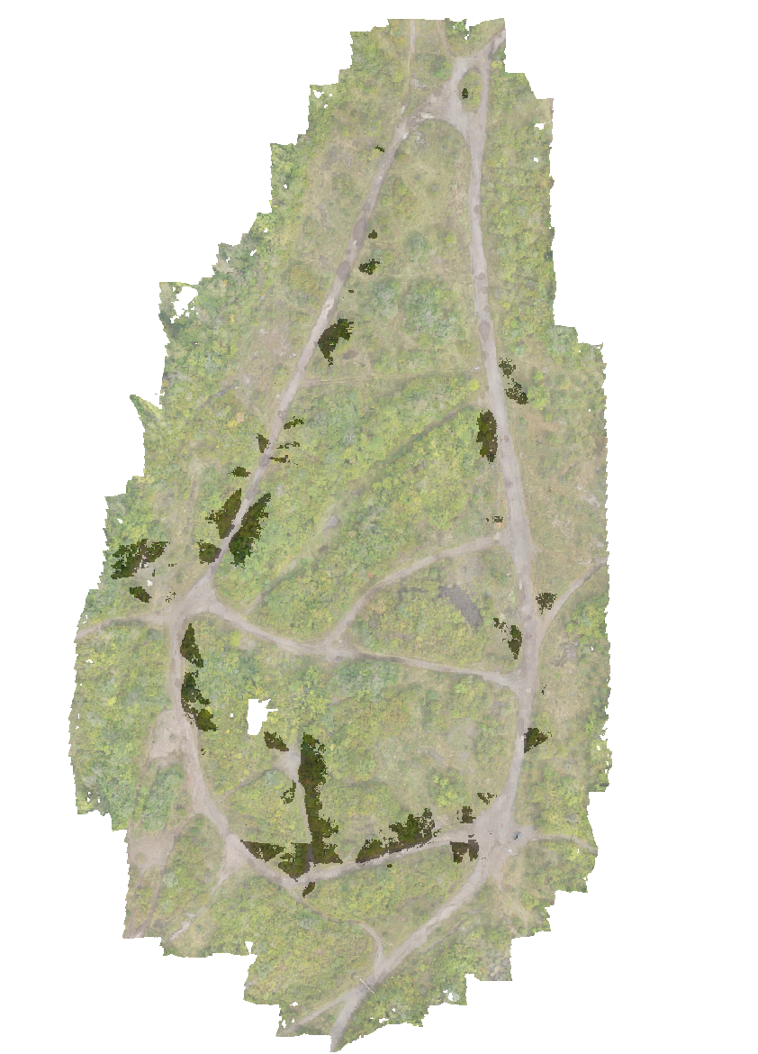
Mapping

1. Mapping

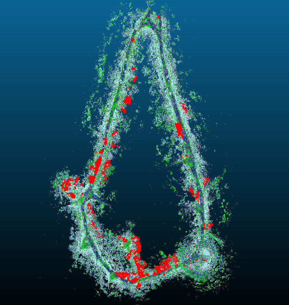
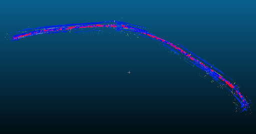
Build a consistent 3D map with GLIM SLAM / photogrammetry from LiDAR trajectories. This map provides the structural reference frame for all semantic labels.
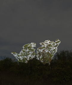
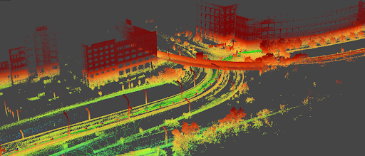
Segmentation

2. Segmentation

Segment Tree-of-Heaven candidates in RGB frames. Per-frame masks provide dense visual evidence that can be fused across viewpoints instead of relying on single detections.

Grounding and geolocalization

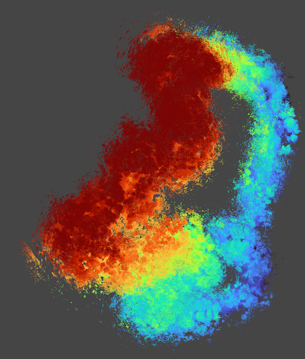
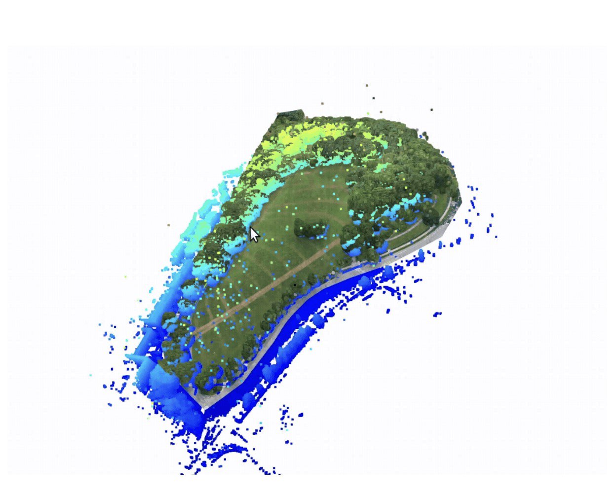
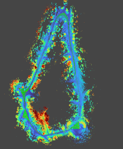
3. Grounding + Geolocalization

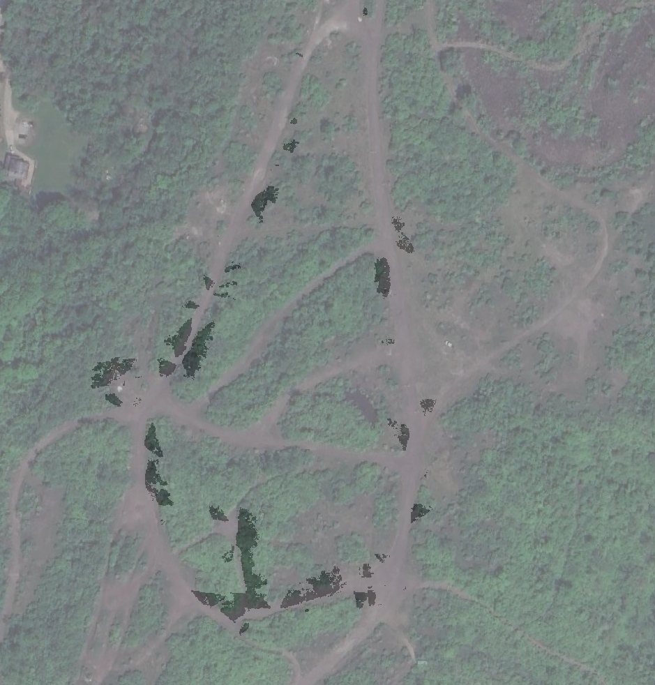
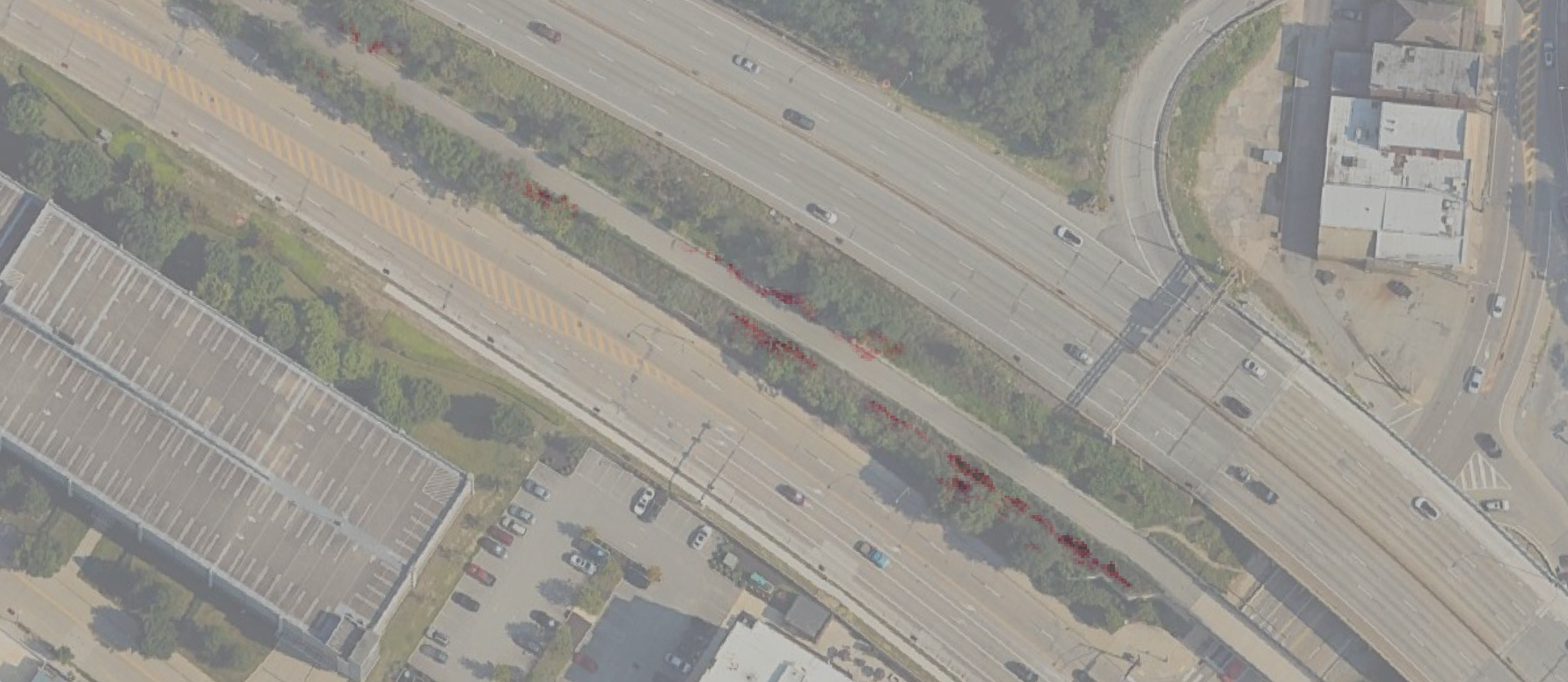
Lift detections into 3D using calibration + SLAM poses, aggregate confidence, then align to global coordinates via GNSS for GIS-ready heatmaps and GeoTIFF export.

Results

Gascola

Gascola heatmap

Heatmap on 3D point cloud

Gascola GeoTIFF overlay

GeoTIFF overlay on Google Satellite view

Download sample files: Full Point Cloud · Tree-of-Heaven points · GeoTIFF

Bike Trail

Bike Trail heatmap

Heatmap on 3D point cloud

Bike Trail GeoTIFF overlay

GeoTIFF overlay (zoomed in) on Google Satellite view

Fly-throughs

Chatham Forest fly-through

Bike Trail fly-through

Datasets

We collected custom datasets using a sensor payload with LiDAR, IMU, GNSS, and RGB images. Environments include bike trails, hike trails, urban parks, and forests. Requests for access can be sent to your project email.

Gascola

Gascola

Bike Trail

Bike Trail

Flagstaff

Flagstaff

Frick Park

Frick Park

CMU Campus

CMU Campus

Chatham Forest

Chatham Forest

For access, email: sszachar@andrew.cmu.edu

Extension: Map Merging

Under-canopy mapping and above-canopy mapping each capture only part of the forest structure. We merge both views to recover a comprehensive, multi-scale reconstruction that supports consistent geolocation and analysis across the full canopy profile.

  • Goal: co-register UCM and ACM into a single aligned map.
  • Impact: denser structure, fewer blind spots, and better forest-wide context.
  • Outcome: a unified product that supports mapping, inspection, and GIS export.
Under-canopy map
Above-canopy map
Merged reconstruction

We gratefully acknowledge the support of the Richard King Mellon Foundation for this project.